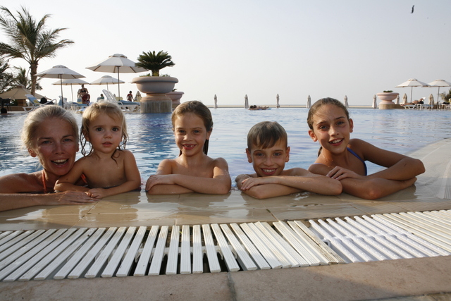
Our summer holidays stretch 10 weeks ahead of us and I am just enjoying the less frenetic pace of life with the Tribe. Early mornings remain the norm (that’s just the way the Tribe’s bodyclocks work) but there is no early morning bundling into cars, checking PE and swim bags and my most disliked task, making three packed snack/lunch boxes. Now I just need to be entertainer extraordinaire 24/7 …
The weather is hotter, much hotter (into the 40s every day now, but so far the humidity is keeping down). When the wind blows in from the vast Empty Quarter, the thermometer temperature may read 45 degrees, but it feels like 55 degrees.
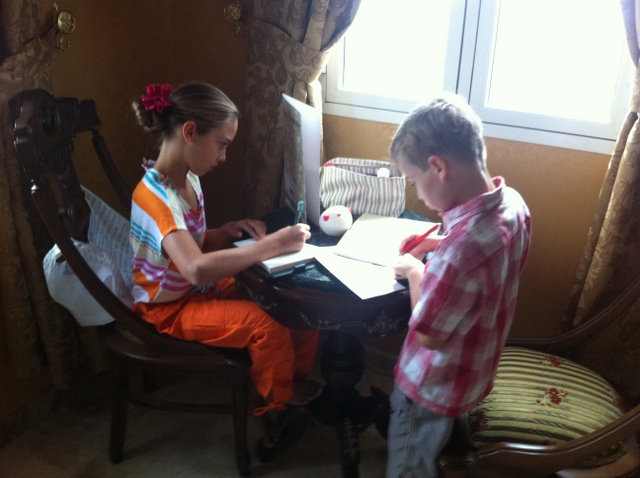
Despite this we have become more accustomed to the heat, but at this time of year, less time is spent outside, unless in a chilled pool and games, puzzles, making camps and general indoor play is the order of the day.
Most of our friends gradually leave Dubai for the summer – husbands are left behind as wives take children back to their various home countries. Bucking this trend, we decide to remain in the region and continue our exploration. Many think that the sun and heat has affected our better judgement. Within a few weeks however, we have plans to drive to Oman and go camping! At this point, people are seriously concerned for our sanity. It turns out however, that the summer offers some of the most spectacular camping in the region.
With the car loaded up, we embark on this latest voyage of discovery. As we cross the border into Oman, the temperature reading is 49 degrees. Bizarrely it also starts to rain – I can’t work out how the raindrops don’t just evaporate in this intense heat.
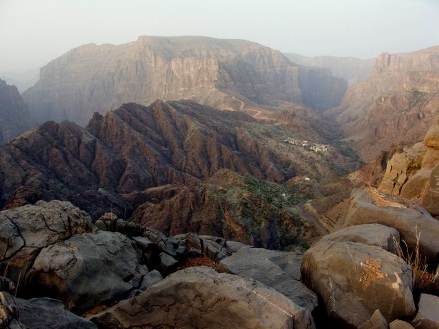
The scenery is fairly flat desert and not particularly outstanding, until that is, we reach the Dhakiliya Region of Oman. It is the heartland of the Sultanate and where the ancient capital of Nizwa lies. The Hajar Mountains divide into the Western and Eastern Hajar and have always been an important trade route between the coast and interior of Oman. Striking forts can be found across the landscape of the region. Our eventual destination is Jebel Al Akhdar, known locally as the Green Mountain. This is the site of the Jebel Akhdar War, probably not one that you have heard of, but one which the British were very much a part of.
In the late 1950s this area saw a conflict between the rebel group of the Imamate of Oman who basically ruled the interior of Oman (backed by Saudi Arabia) and forces loyal to the Sultan of Oman who ruled the coast; this included the British – as it was felt to be an advantage for a British oil company, Iraq Petroleum Company, to have an exit to the sea outside the Strait of Hormuz. The Bani Riyan Tribe of the interior of Oman, mainly settled on the Jebel Akhdar plateau joined the rebels. Seeing Jebel Al Akhdar today makes you realise what a huge advantage the rebels would have had. The cliff faces are sheer and the local population would have had an intimate knowledge of the caves, waterholes and pathways. For the Sultan and his force it must have seemed an almost impossible task to defeat the rebels. Up to this point, only one organised army has ever penetrated Jebel Akhdar, back in the tenth century when the Persians stormed the mountain and although they suffered heavy losses they went on to take the mountain.
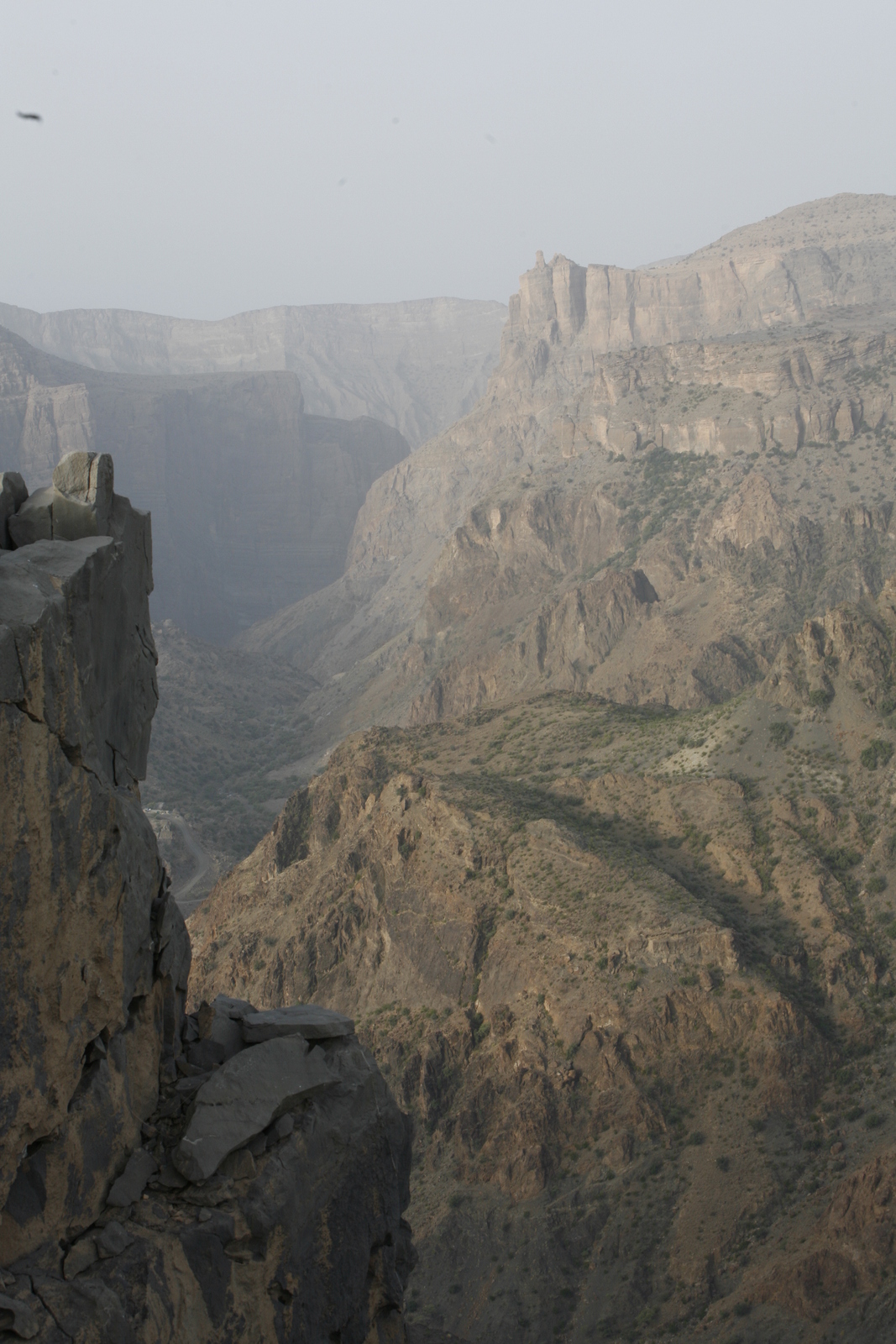
The elevation of the plateau is on average 6,500 ft and it is about 12 miles North to South and 18 miles East to West. The rebels assumed that once on the plateau they were impregnable. They also had supplies of mines, machine guns, mortars, ammunition and radios being sent from Saudi Arabia. With the rebels getting stronger, they started sending patrols to lay mines in the wadis at the base of the mountain, used by the Sultan’s soldiers. At this point Colonel David Smiley arrived on the scene.
After failed air strikes, Smiley asked for either a Royal Marine Commando or an SAS unit as he did not think that ordinary soldiers were fit enough – a mile climb up Jebel Akhdar with supplies, ammunition and weapons would result in the loss of up to 71/2 litres of sweat. Eventually an assault led by the SAS began with the objective of establishing a foothold on the plateau. Despite making it onto the plateau the rebel leaders escaped, eventually fleeing to Saudi. The war however, after 4 years, was finally at an end. The SAS had managed to bring it to its conclusion in just 3 months. Although a small minor war, unimportant on the world stage, it had effectively ensured the continued existence of the SAS. Had the force not been able to demonstrate that it had a use outside the jungle in Malaya, where it had originally been formed, it may very well have been disbanded.
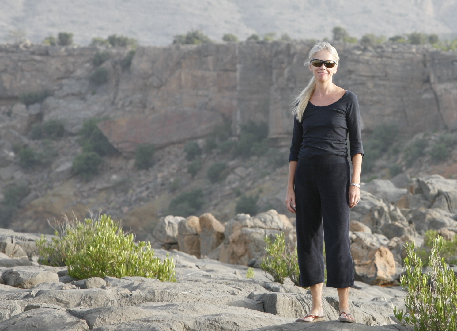
With this history in mind we stop at the checkpoint at the bottom of the mountain; the region was a restricted military zone until 2004. The guard checks our documents and car and counts the number of people. Only 4×4 vehicles are allowed up the mountain due the incredibly steep gradients of the roads. There are frequent accidents hence the reason for noting the number of occupants of each car. The temperature here is in the high 30s. We start the ascent in 4×4 low ratio as instructed by the guard on duty- the road is new and continues for about 35 kilometres up Jebel Akhdar to the Saiq Plateau. The views at every hairpin bend are quite simply awesome. As we climb the temperature is dropping quite markedly. Reaching the plateau, the skies become overcast and it feels rather chilly. Then the heavens open. The rain is torrential and we haven’t yet found a place to camp – August, camping and rain all have a certain deja vu feel about them. We head down a ludicrously narrow and steep road to where I think we should be going, but we just find a quiet, ancient village built into the mountainside at the bottom. Now we have to turn around and make our way back up the road, that has by now become a shallow fast running river. All quite scary, but of course just part of the big adventure… The temperature is now 19 degrees. This was definitely not the plan.
We manage to return to the plateau after another couple of hairy steep drives to dead ends and find Diana’s Viewpoint on the Plateau. This is where the late Princess Diana visited in the 1980s, hence the name. The terrain is flat, rocky and scrubby with
sheer drops off the edge to the bottom of the canyon – obviously perfect for a family with boisterous, young children.
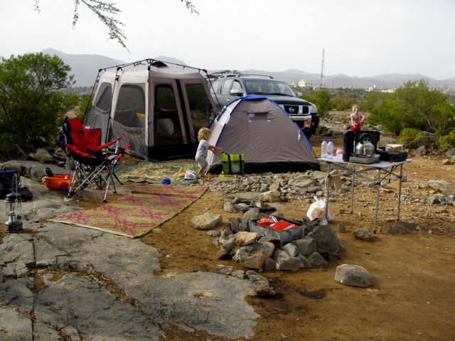
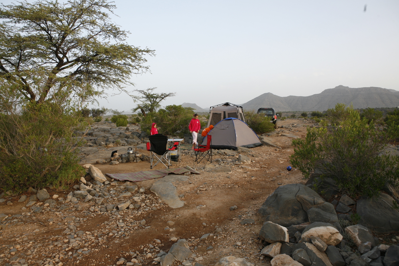
The rain stops and we find a clear spot under an acacia tree
to set up camp. Soon the kettle is on and the Tribe are off looking for fossils in the rocks. Before long they realise that there are fossils embedded into the black rocks everywhere – the rain has disappeared, the temperature is perfect and most importantly, we are all outside again! It is wonderful!
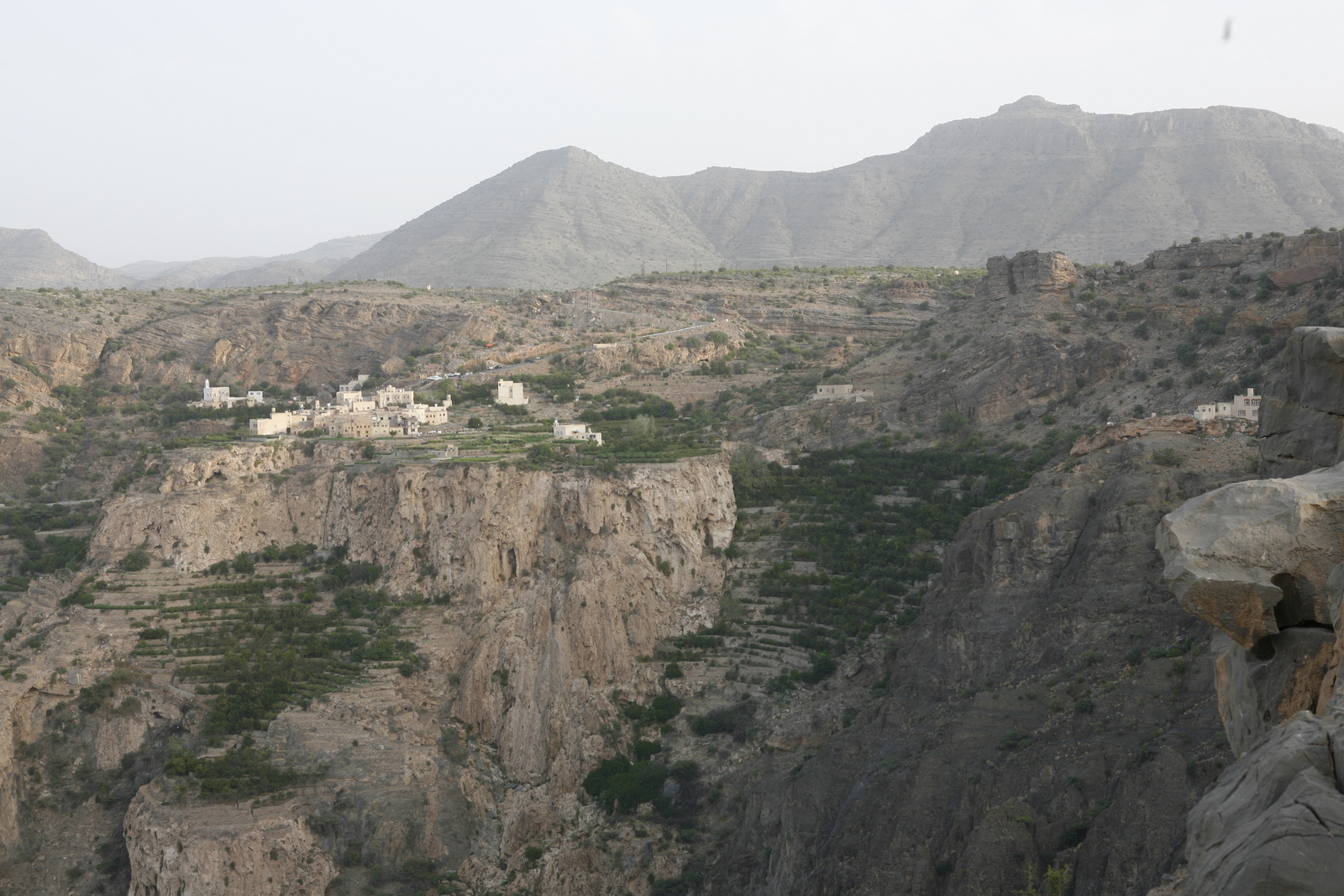
As the sun begins to go down we can see the lights of the villages clinging to the sides of the mountain and the extraordinary terraces where fruit trees and roses grow. Down below us as the light softens, the green valley darkens into an inky blackness. It is still and silent. We all sleep like logs with the delicious scent of the acacia blossom around us.
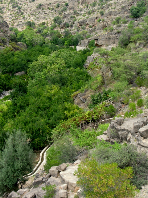
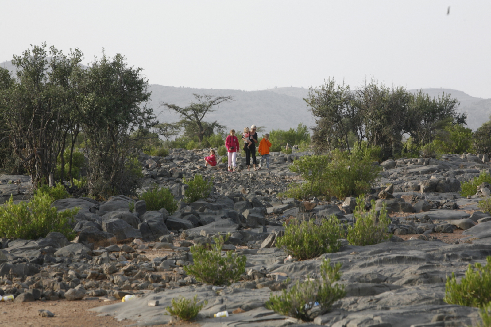
We spend another day hiking along a wadi that takes us to a couple of abandoned villages. The hike starts along steep steps carved into the side of the mountain and we quickly drop into the wadi (river bed normally dry) where it is stunningly green and verdant. Astonishingly there is also the sound of running water. The whole area is full of lush vegetation including pomegranate trees and herbs like jasmine and saffron. Huge walnut trees line the wadi
ensuring that we are walking in dappled sunshine and cool temperatures. Plantations belonging to villagers are fed by the falaj system. Falaj is an Arabic word for an irrigation channel. Their source relies on water from underground aquifers and extracted via tunnels traditionally carved by hand. The aflaj (plural of falaj) in Jebel Akhdar run above ground weaving a
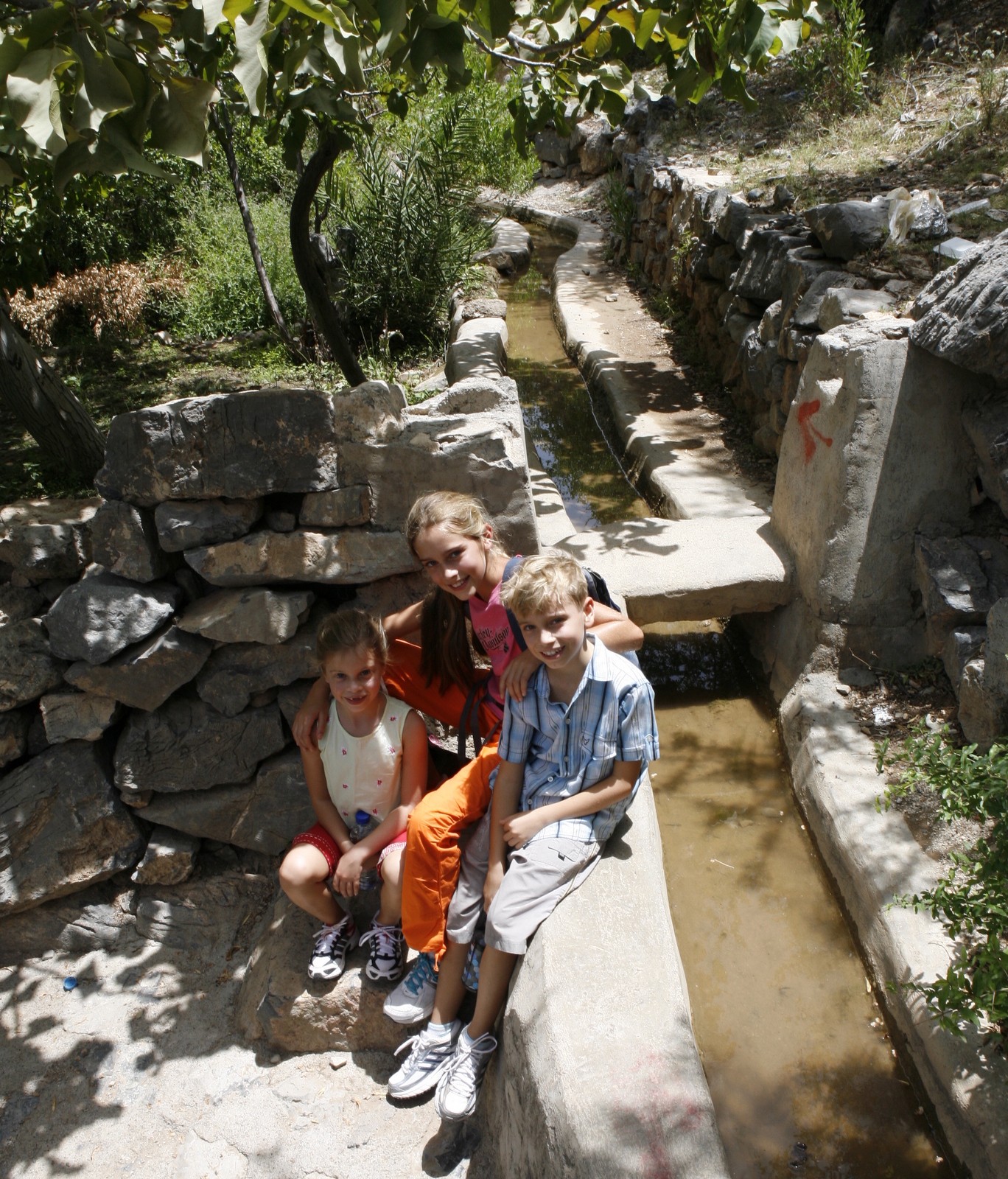
path alongside the wadis. Extraordinarily, 70% of the water used in Oman is delivered by aflaj, a volume of over 900 million cubic metres of water. Stopping for a picnic in the wadi next to a falaj that runs over into a pool, two of the Tribe begin to play a game of Pooh sticks in the falaj – the last time they played this was in Pill Hill Brook along Mill Lane in Abbotts Ann. The falaj here is purported to be the coldest in all of Oman – to us it feels like heaven! Hearing a couple of goatherds above us, we quickly pack away the remains of our food, in order that we don’t insult them should they be fasting during Ramadan (yes, we are in the month of fasting again). They call the goats by a series of whistles and shouts – probably how it has been done for centuries. The goatherds appear as surefooted on the mountainside as the goats.
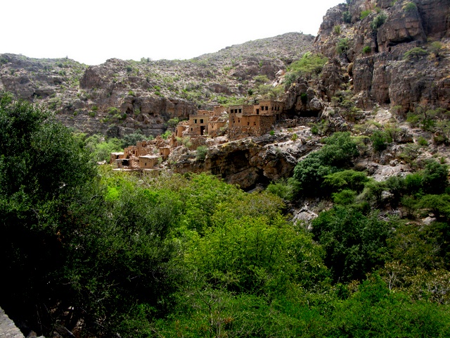
We briefly go into the old village of Bani Habib, abandoned in the 1980s when the villagers moved across the mountain to a village that could be reached by road. The old houses are constructed of mud bricks with no plumbing or electricity and, although charming for a visitor to look at, one can understand why the villagers were happy to move to concrete houses with electricity and plumbing – less charming perhaps but much easier to live in.
It has been a fascinating trip into a very special region. There is so much more to see and explore and we will definitely come back. The memory of sleeping under a star studded night sky, with the distant lights of ancient villages clinging to the mountainside and the scent of the acacia tree will keep us going through the next month of heat and humidity!
Mother of the Tribe
